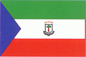
Equitorial Guinea


Formal Name
Equatorial Guinea,
independent republic in western Africa, consisting of a mainland section (Río Muni) on the western coast and the coastal islets of Corisco, Elobey Grande, and Elobey Chico as well as the islands of Bioko (formerly Macías Nguema Biyogo and previously Fernando Po), and Annobón (Pagalu) in the Gulf of Guinea. The total area of Equatorial Guinea is 28,051 sq km (about 10,831 sq mi).Land and Resources
Mainland Equatorial Guinea is bounded on the north by Cameroon, on the east and south by Gabon, and on the west by the Gulf of Guinea. The terrain is gently rolling and heavily forested; about 60 percent of the area is drained by the Mbini (formerly Benito) River. With Corisco and the Elobeys islands it comprises the Río Muni, or Continental, region, an area of 26,017 sq km (about 10,045 sq mi).
The main island of Equatorial Guinea is Bioko (2017 sq km/779 sq mi), which is located off the western coast of Africa in the Bight of Biafra (Bonny). The island, primarily of volcanic origin, is mountainous and thickly wooded, with a steep, rocky coast. Its highest peak is Pico de Santa Isabel (3007 m/about 9865 ft). The island has fertile volcanic soils and is watered by several streams, and lakes are found in the mountains. Together with the small island of Annobón, lying about 640 km (about 400 mi) to the southwest, it comprises the Bioko, or Insular, region. The climate is tropical; the average annual temperature in Malabo is about 25° C (about 77° F) and the annual rainfall is more than 2000 mm (more than 80 in). The wettest season is December through February.
Population
The 1995 estimated population of Equatorial Guinea is 400,000, with many thousands more believed to be living abroad due to political conditions in the country. The overall population density is about 14 persons per sq km (about 37 per sq mi). The population is composed almost entirely of black Africans. The Fang, indigenous to the mainland but now also living on Bioko Island, constitute more than 80 percent of the population. The Bubis, indigenous to Bioko Island, make up about 15 percent of the population. Several smaller ethnic groups live along the mainland coast. Spanish is the official language; however, Fang, a Bantu language, is the most widely spoken. About 90 percent of the people are members of the Roman Catholic church, although traditional beliefs are also widely practiced. The capital, largest city, and principal port of Equatorial Guinea is Malabo, formerly Santa Isabel (population, 1989 estimate, 38,000), on the northern coast of Bioko; Bata (1983, 24,100) is the largest town on the mainland.
Economy and Government
Agriculture is the main source of livelihood in Equatorial Guinea. The principal export crop is cacao, which is grown almost entirely on Bioko. Coffee is grown on the mainland, which also produces tropical hardwood timber, the leading export in value, accounting for 54 percent of earnings in the early 1990s. Cassava and sweet potatoes are the staple foods. Local manufacturing industries include the processing of oil and soap, cocoa, yucca, coffee, and seafood. The currency is the CFA franc (284.6 CFA francs equal U.S.$1; 1993). An exchange rate of 50 CFA francs equal to 1 French franc was enforced from 1948 until 1994, when the CFA franc was devalued by 50 percent.
Under the 1982 constitution, the president was elected by universal suffrage to a seven-year term, and members of the legislature were elected to five-year terms. The Democratic Party of Equatorial Guinea was the sole legal political party. A new multiparty constitution was approved in 1991.
History
The island of Fernando Po was sighted in 1471 by Fernão do Po, a Portuguese navigator. Portugal ceded the island to Spain in 1778. From 1827 to 1844, with the permission of the Spanish government, Great Britain maintained a naval station at Fernando Po and also administered the island. In 1844 the Spanish settled in the area that became the province of Río Muni. In 1904 Fernando Po and Río Muni were organized into the Western African Territories, later known as Spanish Guinea. On October 12, 1968, the territory became the independent republic of Equatorial Guinea, with Francisco Macías Nguema as president. In 1972 Nguema appointed himself president for life. Extreme dictatorial and repressive policies led to the flight of an estimated 100,000 refugees to neighboring countries; at least 50,000 of those who remained were killed, and another 40,000 were sent into forced labor. In 1979 Nguema was overthrown in a military coup, tried for treason, and executed. Lieutenant Colonel Teodoro Obiang Nguema Mbasogo, who led the coup, then became president. Parliamentary elections, based on a single slate of candidates, were held in 1983 and 1988. Although the first multiparty elections took place in November 1993, they were internationally condemned and boycotted by at least half of the eligible voters. Opposition forces called for the boycott after the Obiang Nguema government refused to prepare an accurate electoral roll and guarantee the right to campaign without harassment.